
Extreme Heat Grips Autumn as Super El Niño and Cyclone Arnab Loom
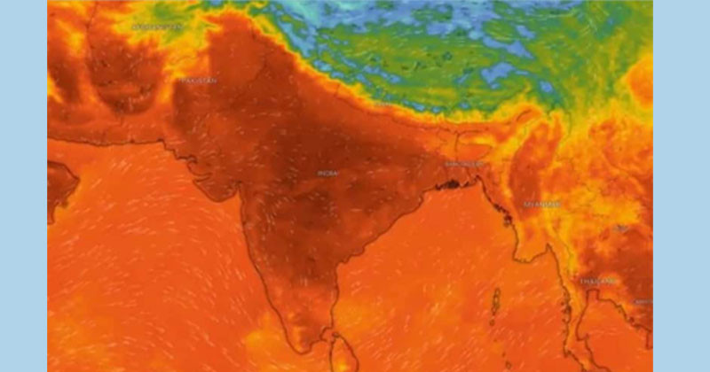
The calendar says it is the Hemanta season, the season of Nabanna. The second week of the month of Kartik is running. Yet the active effect of cyclone Arnab, formed in the Bay of Bengal, has people sweating in humid heat across almost the whole country, including Dhaka. The weather feels like the harsh sun of Chaitra and Baishakh. The air feels like flames.
Yesterday, the highest temperature in the country was 36.8 degrees Celsius in Chattogram. In the capital Dhaka, the temperature also rose to a high of 36 degrees. The forecast says day and night temperatures may rise a little more across almost the whole country today. In South India, authorities keep a red alert in the coastal areas of Andhra and Odisha. The state and central governments stay on full alert because of the strong cyclone Arnab, possible tidal surge and very heavy rain.
In recent years, cyclones have shown a stronger tendency to move toward the Indian coast. Yesterday, temperatures stayed above 36 degrees in most areas, including Dhaka, Chattogram, Mymensingh, Sylhet and Barishal. This is the level of a mild heat wave. Night minimum temperatures also rose to 25 to 28 degrees in most places, including Dhaka. People also suffer from load shedding in the heat. Until yesterday evening, not a drop of rain fell anywhere in the country in the past 24 hours.
Weather and climate experts say the active effect of the strongest “Super El Nino” in a century is at work this year. Rain and clouds have become irregular in many countries, including the Bangladesh India subcontinent. There is high heat, drought, sudden heavy rain and flood. This has caused wide harm to farming, public health, productivity and nature. In Bangladesh, rain has been irregular and drought has continued for the past five to six months. Even in Hemanta, the heat burns the skin.
The Met Office issued a special bulletin yesterday evening. It said a deep depression over the east central Bay of Bengal and the nearby southeast Bay moved northwest and grew stronger. It became a cyclone at 12 noon yesterday and was named Arnab. The cyclone is now over the east central and nearby west central Bay of Bengal. At noon yesterday, it was 840 kilometres southwest of Chattogram Sea Port.
It was also 775 kilometres southwest of Cox’s Bazar Sea Port, 885 kilometres south of Mongla Sea Port and 755 kilometres south of Payra Sea Port. The cyclone is moving west and northwest. It is becoming a strong cyclone over the west central Bay of Bengal. It will then slowly grow into a very strong cyclone. It may cross the Andhra coast of India tomorrow, Wednesday.
Within 54 kilometres of the centre, the steady maximum wind speed is 62 kilometres per hour. In gusts it rises to 88 kilometres per hour. The sea is very rough near the centre of the deep depression. Chattogram, Cox’s Bazar, Mongla and Payra sea ports have been told to show distant warning signal number two. Meteorologist Mr. Md. Shahinul Islam gave the forecast until this evening.
He said light rain or thunder showers with gusty wind may occur in one or two places of Chattogram, Khulna and Barishal divisions. Elsewhere, the weather may stay mostly dry with partly cloudy skies. Day and night temperatures may rise slightly across the country. The forecast until tomorrow evening says light rain or thunder showers with gusty wind may occur in some places of Chattogram, Khulna, Barishal and Sylhet divisions. One or two places of Dhaka and Mymensingh divisions may also see them.
Elsewhere, the weather may stay mostly dry with partly cloudy skies. Day and night temperatures may stay almost unchanged across the country.